
| Weather Data from Sunnybank Weather Station | |||
|---|---|---|---|
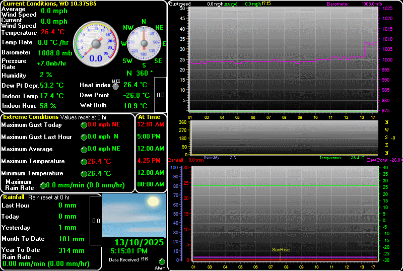
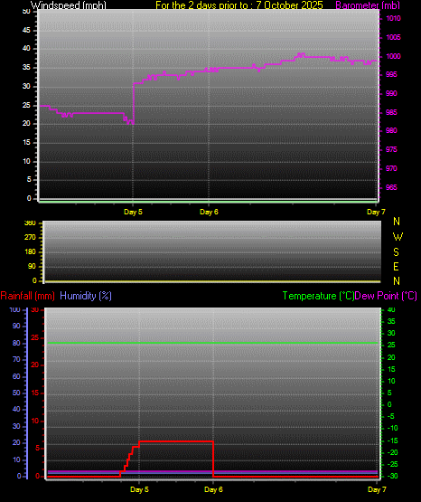
| LAST READING AT TIME: 5:15 PM DATE: 13 October 2025, time of next update: 5:30 pm | |||
| Current Weather | Dry | Current Temperature | 26.4°C (79.5°F) (Heat Index 25.2°C ), Apparent temp 24.9°C |
| Maximum Temperature (since midnight) | 26.4°C at: 4:25 PM | Minimum Temperature (since midnight) | 26.4°C at: 12:00 AM |
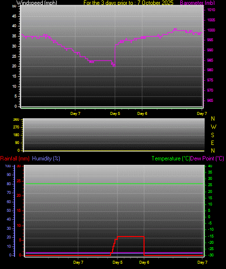
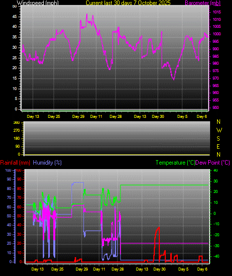
| Average windspeed (ten minute) | 0.0 mph | Wind Direction (ten minute) | N (360°) |
| Heat Index | 25.2°C | Maximum Gust (last hour) | 0.0 mph at: 5:00 PM |
| Maximum Gust (since midnight) | 0.0 mph at: 12:01 AM | Maximum 1 minute average (since midnight) | 0.0 mph at: 12:00 AM |
| Rainfall (last hour) | 0.0 mm | Rainfall (since midnight) | 0.0 mm (0.00 in.)--- |
| Rainfall This month | 101.3 mm (3.99 in.) | Rainfall To date this year | 314.3 mm (12.37 in.) |
| Maximum rain per minute (last hour) | 0.0 mm/min | Maximum rain per hour (last 6 hours) | 0.0 mm/hour |
| Yesterdays rainfall | 1.2 mm | DewPoint | -26.8°C (Wet Bulb :10.9°C ) |
| Humidity | 2 %, Humidex 21.2°C | Barometer corrected to msl | 1008.0 mb |
| Pressure change | +7.0 mb (last hour) | Trend (last hour) | RISING SLOWLY |
| Pressure change (last 12 hours) | +9.0 mb | Pressure change (last 6 hours) | +9.0 mb |